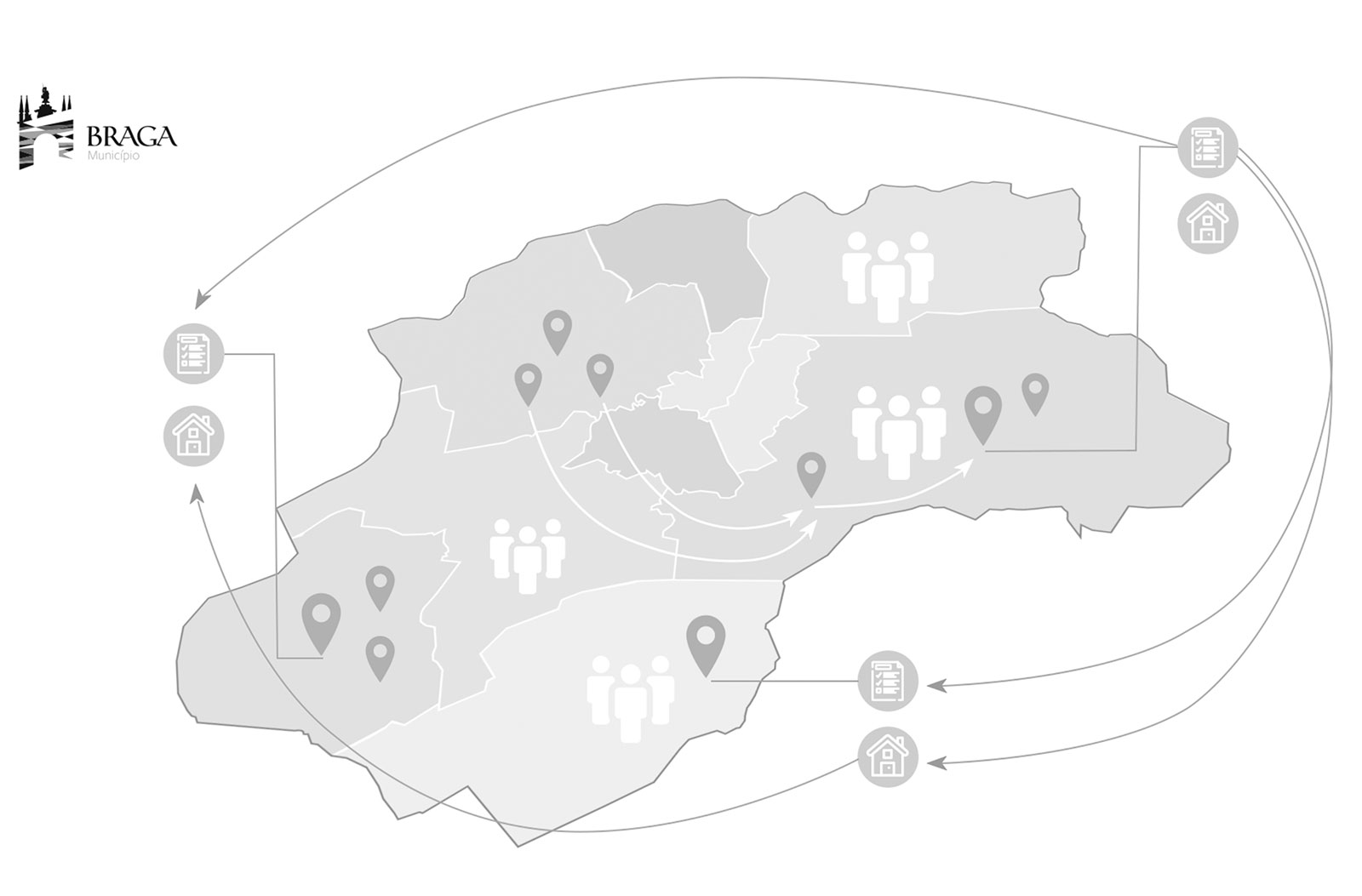
Geographic Information Systems attribute to being a simple tool for processing geographic data, they have become powerful Asset Planning and Management Systems, applying to the most varied areas, from management and territorial to infrastructures, through tourism, mobility , social action, education, among others.
Operating in both the public and private sectors, we use GIS to address the most varied challenges that come before our customers, while also expressing the results in an easily and quickly understood and shared way.
The scope of the LRB's activities in this area is quite broad, and it can start to develop or integrate platforms, where we create management and decision support tools for various purposes, up to the production of information through cadastral surveys carried out with the latest technologies. . , including the use of drones. The existence of duly validated and updated information is today a key factor in the daily life of any entity.